This page is a placeholder. So is the sign it belongs to. Both will stay that way until the right people write them.
What happened
The Mill River Trail signage project produced thirteen interpretive signs. They are good signs. They cover the Whitney dam, the Fenian Ram, the city bath houses, the tide gate, Grapevine Point and the 29th Connecticut, Dragon Point and the oyster fleet, the highway that residents stopped, and William Lanson, who built the wharf that made New Haven a port.
The project's own research overview opens with a sentence about Indigenous people hunting and fishing along this river for centuries before English colonists put up the first mill in 1642 — and then does not come back to it. Thirteen signs, four hundred years, and the several thousand years before that get a subordinate clause.
That is not unusual. It is close to standard. Which is the problem.
Why we did not just write it
We could have. The sources exist in the sense that books exist: colonial deeds, a 1638 agreement, place-name etymologies of varying reliability, archaeological summaries. Assembled by us, at this distance, they would have produced a competent-sounding panel about people described entirely in the past tense, written by people with no standing to describe them, and it would have been bolted to a post in metal.
Interpretive signs are unusually good at making a version of the past feel settled. That is exactly why the first draft of this one should not come from us.
What this sign needs
- Someone with the standing to write it, found honestly. This is the hard part, and it is worth saying plainly why. The Quinnipiac are not a federally or state-recognised nation. Connecticut recognises five tribes — Mohegan, Mashantucket Pequot, Eastern Pequot, Schaghticoke and Golden Hill Paugussett — and none of them is Quinnipiac. The organisation that uses the Quinnipiac name most visibly online is an unrecognised heritage nonprofit headquartered in Indiana, and its history does not survive checking. Our own project notes named a "Quinnipiac Dawnland Council" that does not appear to exist. So the first task is not writing. It is asking, through the state's Indian Affairs Council, the Native American Heritage Advisory Council and the State Archaeologist, and following the protocol CT Humanities publishes for exactly this situation. - Primary sources, community-reviewed. The Native Northeast Research Collaborative — the former Yale Indian Papers Project, a mile from this river — has spent two decades digitising and annotating the documentary record with the relevant communities. Anything written here should start there rather than with a summary of a summary. - A decision about where it goes. The coordinates behind this page are a placeholder on the tidal reach below East Rock, chosen so the locator map has something to draw. The right location is part of what needs deciding. - A decision about what it is. Whether it is one sign, several, or a different kind of thing entirely is not ours to settle. - Present tense. The Quinnipiac are not a closed chapter, and a sign that reads like an obituary would be worse than no sign.
The rest of the trail is revisable too
Every sign on this trail is a text file that can be edited and a plate that can be reprinted. Nothing here is fixed. If the story of this river needs to be told differently — on this panel or on any of the others — that is a change to a paragraph, not a campaign.
If you can help, or if you think this framing is itself wrong, the trail wants to hear it.
The sign at this spot
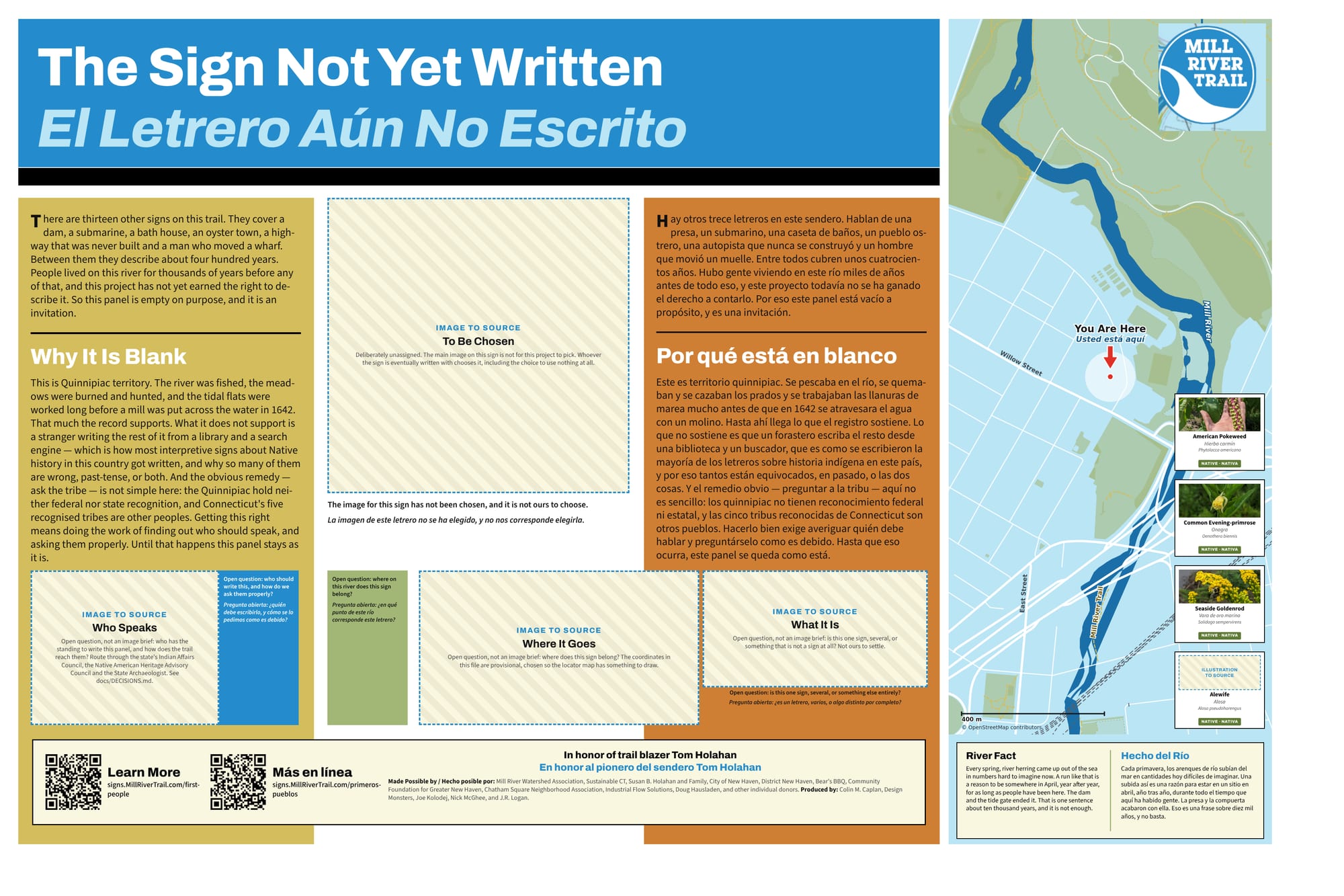
The full sign, in English and Spanish. Zoom in to read it.
This sign is deliberately unwritten, and is not going to be printed as it stands. It is here so the gap is visible and can be answered.
Sources and further reading
Where a link goes to a scanned original — a newspaper page, a map, an engineering journal — it is the actual document, not a summary of it.
- Working with Indigenous Communities — CT Humanities
- Native Northeast Portal — Quinnipiac
- Native Northeast Research Collaborative (formerly the Yale Indian Papers Project)
- Connecticut law on Indian tribes — Office of Legislative Research
- Tribal Affairs — Connecticut DEEP
- Quinnipiac: The People of Long Water Land — Connecticut History
- Mill River history — Mill River Trail
Research and credits
Historical research for the Mill River Trail signage was carried out by Colin M. Caplan of Magrisso Forte and John R. Logan, with contributions from Jason Bischoff-Wurstle of the New Haven Museum and walk notes by Steve Hamm. Images are credited individually. Locator maps are drawn from OpenStreetMap, © OpenStreetMap contributors, ODbL.
This page last changed 2026-10-12.