NewHavenMuseum.jpg)
Stand on the Grand Avenue bridge and look down. Almost none of the ground around you is original. The Mill River here ran through a wide tidal marsh — mud, grass and shifting channels, flooded twice a day — and the solid land you are standing on is fill, carted in and dumped over the course of a century to raise the grade above the high tide mark.
What a marsh was for
A tidal marsh is not empty ground waiting to be improved, though that is exactly how New Haven's English settlers and the developers who followed them understood it. Marsh grass anchors sediment. The marsh shelters young fish, shellfish and birds. Above all it absorbs water: it takes a storm surge coming in off the harbour and slows it down before it reaches the street, and it takes fresh water coming down the river in flood and spreads it out. Filling a marsh removes that capacity permanently.
What the marsh did produce, colonists could see: salt hay. By the 1830s people were cutting it off Ball Island for animal bedding and fodder.
.jpg)
Allen Ball's bad land
The river splits here, and the ground between the channels became Ball Island. It takes its name from Allen Ball, a farmer working for John Davenport, the minister who founded the New Haven Colony. Ball came into the land around 1641 through a deed to his brother-in-law.
The island was considered bad land. It flooded constantly, it was muddy, and for two centuries nobody could think of much to do with it. It drifted into use as common ground. By the 1860s the lumber yard next door had taken it over, and industry had arrived on the river for good.
Barnesville
The corner of Grand Avenue and East Street, running down to the river, was once called Barnesville. It was named for Eli Barnes, a real estate developer and oyster farmer who built an inn on Grand Avenue around 1812, shortly after his marriage. He called it the Lafayette Hotel and hung a swinging portrait of the General on the front.
There was almost nothing else here at the time. Getting to Fair Haven meant going all the way up State Street to cross the Mill River. In 1819 Barnes helped pay for a bridge at this spot, privately, and cut the journey short. The bridge fell into disrepair quickly and the city spent the following century replacing it.
When the New Haven and Hartford Railroad opened in 1839, the calculation changed. Land next to a river and a rail line was worth filling.
CityDirectory.jpg)
The Kickapoo Indian Medicine Company
In 1887 two businessmen, Charles Bigelow and John E. Healy, moved their patent medicine works into a large brick warehouse at 521-525 Grand Avenue, across the river from Ball Island. They made and bottled Indian Sagwa, Indian Oil, Indian Worm Killer, Kickapoo Salve and Kickapoo Cough Cure.
The company sold its products as authentic Native remedies, claiming a connection to a Texas band of the Kickapoo Nation. That claim was marketing. Healy and Bigelow were white promoters who had come out of the travelling-show business, and the Kickapoo name and imagery were borrowed to sell bottled alcohol and vegetable extract to white customers. The company ran large touring troupes that performed staged "Indian medicine shows" across the country, and it employed Native performers, a number of whom lived in the neighbourhood around this warehouse.
It was one of the most successful patent medicine operations in the United States. It moved to 441 Chapel Street in 1893.
NewHavenMuseum2.jpg)
What came next
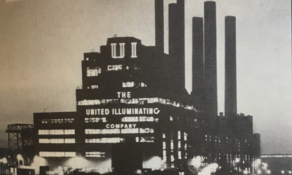
In 1890 the New Haven Electric Light Company built a power plant on the south side of Grand Avenue on Ball Island — one of the earliest electrical generating stations in the country, burning coal delivered by ship. As demand grew, the United Illuminating Company began work on its successor, English Station, in 1927. It began generating in 1929 and ran until 1992.
By 1970 the Mill River was measured at four times the legal limit for swimming. It has been recovering since the industry left.
.jpg)
The building that is still an argument
Look at it. A brick and steel powerhouse on an island in a city river, empty since 1992, roof open, windows gone. The 1890 plant beside it was demolished in 2021; English Station was not.
It is not standing because anyone wants it. It is standing because of what is inside it. The site is contaminated with PCBs, asbestos, petroleum hydrocarbons and arsenic, and who pays to remove them has been in dispute for most of this century.
The short version, and it is genuinely worth knowing, because it is the same argument this whole river has been having since the 1880s:
- When the state approved the merger that folded United Illuminating into Avangrid, cleaning up English Station was made a condition of the deal. - A 2016 partial consent order required UI to get PCBs inside the building down to one part per million, within three years. - It did not happen. In January 2024 the Connecticut Attorney General sued UI to enforce the order. - In August 2025 a judge found the cleanup terms ambiguous — the state reads them as covering everything inside the building that contains PCBs, the company reads them as covering only where PCBs were spilled — and sent the question back to the state. - As of late 2025, remediation was restarting, and the city was weighing what the site could become.
Thirty-odd years of an empty building, and the argument is still about where the line falls between what a company spilled and what a company owes.
(That sequence is current to the end of 2025. If you are reading this years later, it has almost certainly moved on — and the fact that you have to ask is itself part of the story.)
The sign at this spot
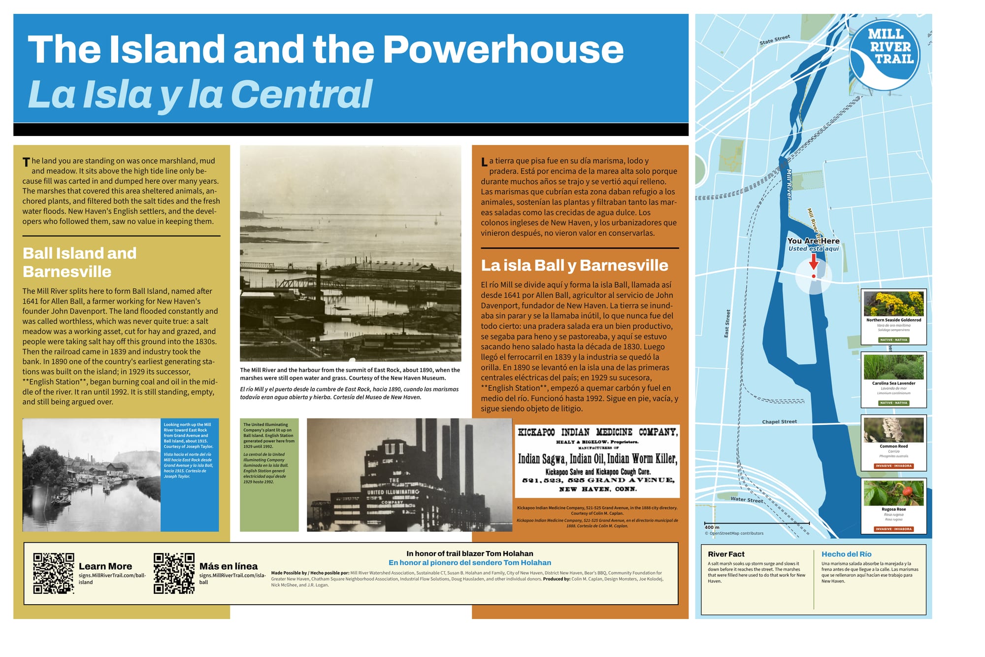
The full sign, in English and Spanish. Zoom in to read it.
Sources and further reading
Where a link goes to a scanned original — a newspaper page, a map, an engineering journal — it is the actual document, not a summary of it.
- Ball Island — Mill River Trail
- Barnsville — Mill River Trail
- CT sues United Illuminating over the English Station cleanup — CT Mirror, January 2024
- Judge sends the English Station cleanup dispute back to DEEP — CT Mirror, August 2025
- English Station cleanup to resume — New Haven Independent, October 2025
- English Station — New Haven Building Archive, Yale
- Energy infrastructure in New Haven — Yale
- 1888 map showing Mill River Island — Library of Congress
- 1934 aerial survey of New Haven — Connecticut State Library
- Eli Barnes and the Lafayette Hotel — In Memory of Alfred Smith Barnes
- Mill River Watershed Based Plan — Save the Sound
Research and credits
Historical research for the Mill River Trail signage was carried out by Colin M. Caplan of Magrisso Forte and John R. Logan, with contributions from Jason Bischoff-Wurstle of the New Haven Museum and walk notes by Steve Hamm. Images are credited individually. Locator maps are drawn from OpenStreetMap, © OpenStreetMap contributors, ODbL.
This page last changed 2026-10-12.