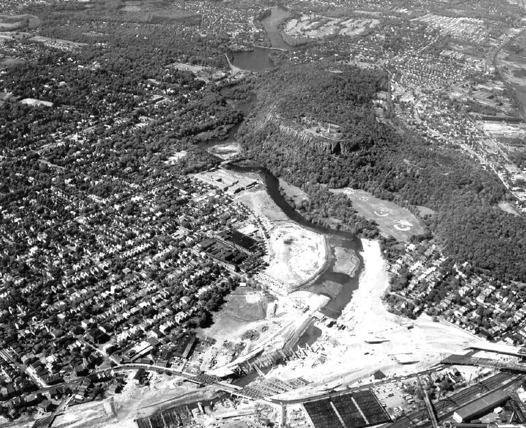
Most of what happened to the Mill River happened to it. Marshes were filled, banks were walled, factories were built and the water was used as a drain, and at no point does the record show much of an argument about it.
This stretch is the exception. Here, something was proposed, fought over, and not built.
The proposal
In 1942 New Haven's planners first considered running an arterial road over the Mill River and through East Rock Park. The idea was reconsidered intermittently into the 1950s. By 1959 and 1960, the city, the state and the highway engineers were broadly in agreement about the purpose and the route.
From a 1950s traffic-engineering point of view it was obvious. A river valley is a natural corridor: flat, continuous, already partly cleared, and running in the direction traffic wanted to go. Park land was cheap because the city already owned it.
What was actually drawn
The East Rock Connector was a four-lane expressway, a little over a mile long, from Interstate 91 at Exit 6 — Willow Street and Blatchley Avenue — north to an intersection at Whitney Avenue and Armory Street in Hamden. The Connecticut Highway Department was the sponsor, and the federal Bureau of Public Roads would have paid half. The estimate was $5 million in 1964 and about $10 million by 1968.
The design is the part worth pausing on. To save land, the two carriageways were to run on opposite banks of the Mill River — and the river between them was to be straightened, narrowed and encased in a concrete channel, functioning as the highway's median strip. North of Orange Street the northbound lanes would cross back over, and the road would run along the foot of the rock.
The river was not an obstacle to be bridged. It was to be the gap between the lanes.
The fight
Opposition built between 1961 and 1965 as the drawings made the scale of the taking clear — residents of East Rock, Cedar Hill and Fair Haven, and of Spring Glen over the Hamden line, together with the city's own Park Commission. The New Haven Register, which supported highway building generally, came out against this one, arguing that the state was trying to steamroll its wishes against those of the people the road would harm.
In 1964 State Representative Lawrence O'Brien led the opposition in the legislature, arguing the connector would not relieve congestion at all but simply concentrate it at the northern end, dumping traffic onto Whitney Avenue.
The law that killed it
And here is why this fight matters beyond New Haven.
In 1965 the Connecticut General Assembly passed what is now section 7-131j of the General Statutes. It says that where the state wants to take municipal land held for conservation or recreation and use it for a highway, it must provide comparable replacement land or pay for it; it must hold an extra public hearing, at which it must state its "reasons for the proposed taking of the open space land rather than other land"; and:
the state shall not take, for highway or other purposes, any such land unless the governing body of the municipality in which the land is located has, by majority vote of all its members, approved the proposed taking.
A town could now say no. New Haven's Board of Aldermen withheld approval, and the connector became legally untenable. It was formally abandoned around 1970.
The federal government did not enact equivalent protection for parkland until the following year, in Section 4(f) of the Department of Transportation Act of 1966. A neighbourhood argument about this river bank helped produce a state law that got there first.
What it cost anyway
Interstate 91 was built, along the eastern edge, between 1962 and 1966, and it took roughly ten acres of park, meadow and tidal marsh with it. The park you can walk in today is what survived the compromise, not what was defended.
The road that is still half there
Go and look at Exit 6. The interchange was built to feed a highway that was never built, and it shows: oversized ramp structures, viaducts straddling the river, and ramp stubs that simply stop. It is the clearest physical evidence on this trail of something that did not happen.
Why this matters on a trail sign
Almost every other sign on this trail describes something the city did to the river without much public argument. This one describes the moment the argument was had, in public, and the public won part of it.
The trail you are standing on exists because that stayed true: people who use a place turn out to be the ones who defend it.
The sign at this spot
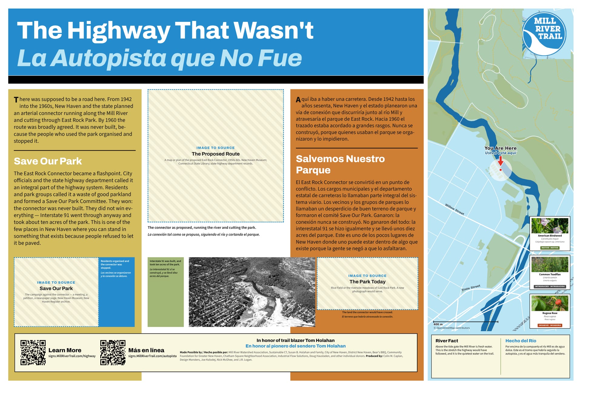
The full sign, in English and Spanish. Zoom in to read it.
This sign is still a draft. The hatched boxes are photographs that have not been sourced yet.
Sources and further reading
Where a link goes to a scanned original — a newspaper page, a map, an engineering journal — it is the actual document, not a summary of it.
- Conn. Gen. Stat. § 7-131j — taking of municipal open space land by the state
- The East Rock Connector — Connecticut roads (kurumi.com)
- CT 10A Expressway (unbuilt) — NYCRoads
- The East Rock Connector — Connecticut roads
- Report of the New Haven Civic Improvement Committee, 1910
- Mill River Trail Framework Plan
- Mill River history — Mill River Trail
Research and credits
Historical research for the Mill River Trail signage was carried out by Colin M. Caplan of Magrisso Forte and John R. Logan, with contributions from Jason Bischoff-Wurstle of the New Haven Museum and walk notes by Steve Hamm. Images are credited individually. Locator maps are drawn from OpenStreetMap, © OpenStreetMap contributors, ODbL.
This page last changed 2026-10-12.