There is a particular kind of document that New Haven has produced roughly every twenty-five years since 1910: the plan for the Mill River. Reading them in order is a good way to understand how the city has thought about water, industry and its own future — and how consistently it has known what it ought to do.
1910: Gilbert and Olmsted
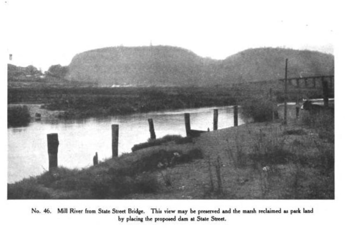
Cass Gilbert and Frederick Law Olmsted prepared the city's first modern plan, presented to the Civic Improvement Committee in 1910. It proposed an inner circuit of parks, parkways and reservations linked by paths that would never have to cross a highway.
On the Mill River specifically it asked for a buffer of open land along the water, instead of the artificial vertical walls the city was already starting to build to control the river's course. It warned that the buffer would also hold back the coming density of double-decker housing. And it noted, in 1910, that pollution was already a problem at low tide.
The city built the walls.
1941: Rotival reads the same valley backwards
Maurice E. H. Rotival was a French planner teaching at the Yale School of Architecture when the City Plan Commission hired him in 1941. He thought about cities as organisms — flows of freight, industry and traffic — and when he looked at the Mill River he saw the exact inverse of what Gilbert and Olmsted had seen.
Where they had wanted a green buffer between the neighbourhoods and the factories, Rotival zoned the river lowlands, Cedar Hill and the harbour shore for heavy industry, freight rail and limited-access highways. He was the first to identify the valley as a natural north-south transit spine, and the first to propose a high-speed road running down it at the foot of East Rock.
He came back in 1951 with an "Equilibrium Plan" that said it again: residential on the high ground to the west, logistics and motor traffic in the river valley.
Nothing about the river had changed. The way of looking at it had.
1954: the plan becomes bulldozers
Under Mayor Richard C. Lee and redevelopment director Edward Logue, New Haven became the country's most famous test case for federal urban renewal money — and Rotival's diagrams became contracts. The Mill River Redevelopment Area cleared blocks of nineteenth-century housing, shops and small works in the Wooster Square and Fair Haven borderlands, and replaced them with single-storey plants and truck distribution yards.
The road that wasn't built
The arterial down the valley was the last piece, and the one that failed.
By 1959 and 1960 the city, the state and the highway engineers broadly agreed on the route. Then the drawings circulated, and people saw that the Mill River itself was to be straightened into a concrete channel and used as the median between the two carriageways.
The fight ran from 1961 to 1965 and ended in the statute book: a state law that stopped the highway department taking municipal parkland without the city's own aldermen approving it by majority vote. New Haven's aldermen refused. The East Rock Connector was never built.
Interstate 91 still went through, and took about ten acres. Sign 10, at the foot of the rock, tells that story properly.
1987 and 2013
The Mill River Municipal Development Plan of 1987 and the Mill River District Plan of 2013 both start from the opposite premise to Rotival's: that the river is an asset rather than an obstacle, that industrial land near water is worth reclaiming rather than expanding, and that people should be able to get to the water's edge.
One of them got built
Almost everything on this page is a plan that did not happen. Gilbert and Olmsted's parkway was shelved. Rotival's arterial was stopped. The connector died in the statute book.
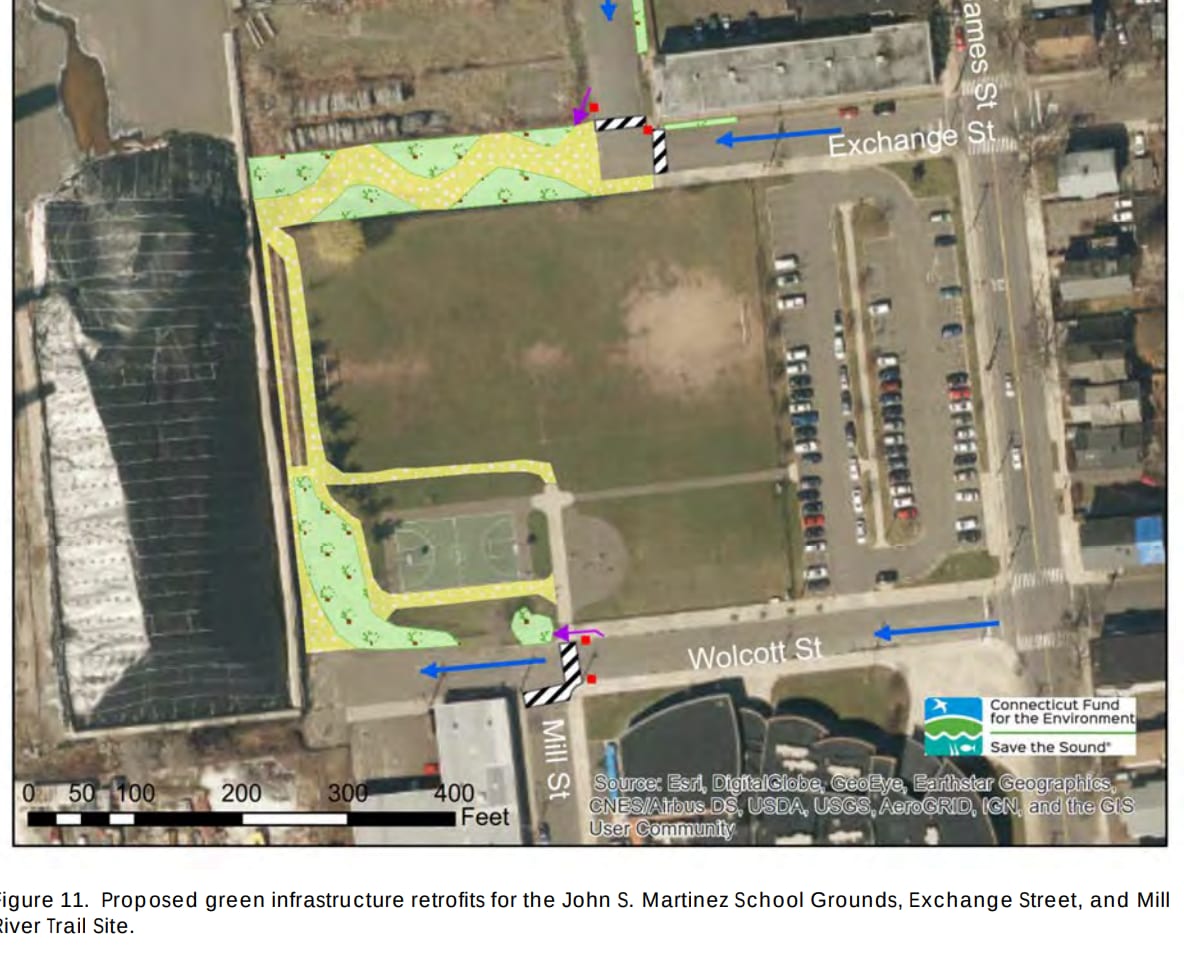
So it is worth pointing at the drawing in the corner of this sign, because that one is real now.
It is a 2018 proposal by Save the Sound and the City for the John S. Martinez School grounds at Exchange Street — a plan to pull up a dead stretch of roadway and let the ground absorb its own rainwater instead of flushing it into the river. In 2022 it was built. Nearly twelve thousand square feet of asphalt came out. Three hundred native plants went in, with bioretention gardens and swales to catch the runoff, a walkway that joins the trail, and a mural called Born to Explore.
A hundred and twelve years after Gilbert and Olmsted told the city to leave the river some ground, somebody left it some ground.
The thing they all agreed about
Every one of these plans, across a century of otherwise incompatible assumptions, says some version of the same sentence: people should be able to walk along this river.
It took until now to build it.
The sign at this spot
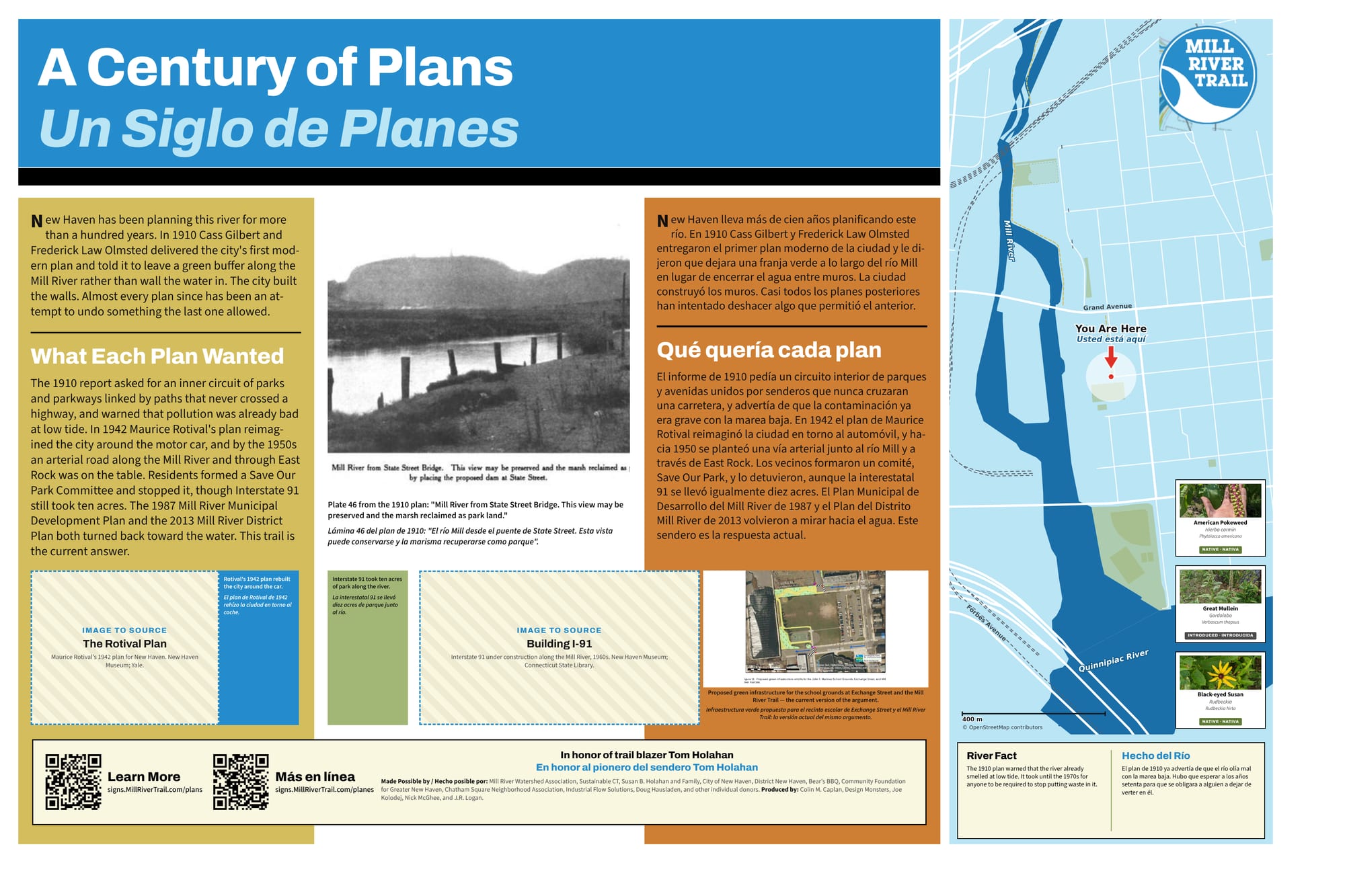
The full sign, in English and Spanish. Zoom in to read it.
This sign is still a draft. The hatched boxes are photographs that have not been sourced yet.
Sources and further reading
Where a link goes to a scanned original — a newspaper page, a map, an engineering journal — it is the actual document, not a summary of it.
- Mill River Trail Green Infrastructure Park — Save the Sound
- Report of the New Haven Civic Improvement Committee, 1910 — Gilbert and Olmsted
- Mill River District Plan, 2013
- Mill River Trail Framework Plan
- The East Rock Connector — Connecticut roads
- Mill River Watershed Based Plan — Save the Sound
Research and credits
Historical research for the Mill River Trail signage was carried out by Colin M. Caplan of Magrisso Forte and John R. Logan, with contributions from Jason Bischoff-Wurstle of the New Haven Museum and walk notes by Steve Hamm. Images are credited individually. Locator maps are drawn from OpenStreetMap, © OpenStreetMap contributors, ODbL.
This page last changed 2026-10-12.