The tide reaches about six feet here. Twice a day salt water comes up the Mill River from New Haven Harbor, floods the channel and the mud either side of it, and then drains back out. Everything that lives in this stretch organises its life around that.
Why estuaries are worth so much
An estuary — where a river meets the sea — is among the most productive habitat on earth, more productive per acre than farmland. Fresh water arrives carrying nutrients from upstream, the tide stirs and redistributes them, and the shallow water lets sunlight reach the bottom. Marsh grass grows in it faster than almost anything else, dies back, and feeds everything.
It is also a nursery. A great many fish that spend adult life offshore spawn or grow up in estuaries, because the shallows are warm and the predators are big enough to be excluded.
Making a living on the swing
The catch is that conditions here change completely every six hours. Salt, temperature and whether you are underwater at all — all of it swings. Nothing here can afford to be a specialist.
Ribbed mussels sit half-buried among the cordgrass roots, filtering when the tide covers them and clamped shut when it does not. Their byssal threads bind the mud together; a bank with mussels erodes far more slowly than a bank without.
Fiddler crabs dig burrows that trap water at low tide. The males have one hugely enlarged claw, useless for feeding and used for waving at females and threatening other males.
Mummichogs are the small tough killifish of every Atlantic marsh. They ride the flood up over the mud to feed and drop back on the ebb, and they tolerate temperature, salinity and oxygen swings that would kill almost anything else.
Egrets, herons and osprey show up because the falling tide concentrates prey into shrinking pools. Low tide is feeding time.
What to watch for
Low tide is the interesting one — mud flats exposed, crab burrows visible, birds working the edges. The tall feathery reed spreading along the banks is Phragmites, and the very large white swans are mute swans: both introduced, both aggressive, and both a problem for the native marsh.
Check a New Haven Harbor tide table before you come. The river is a different place at each end of the cycle.
The sign at this spot
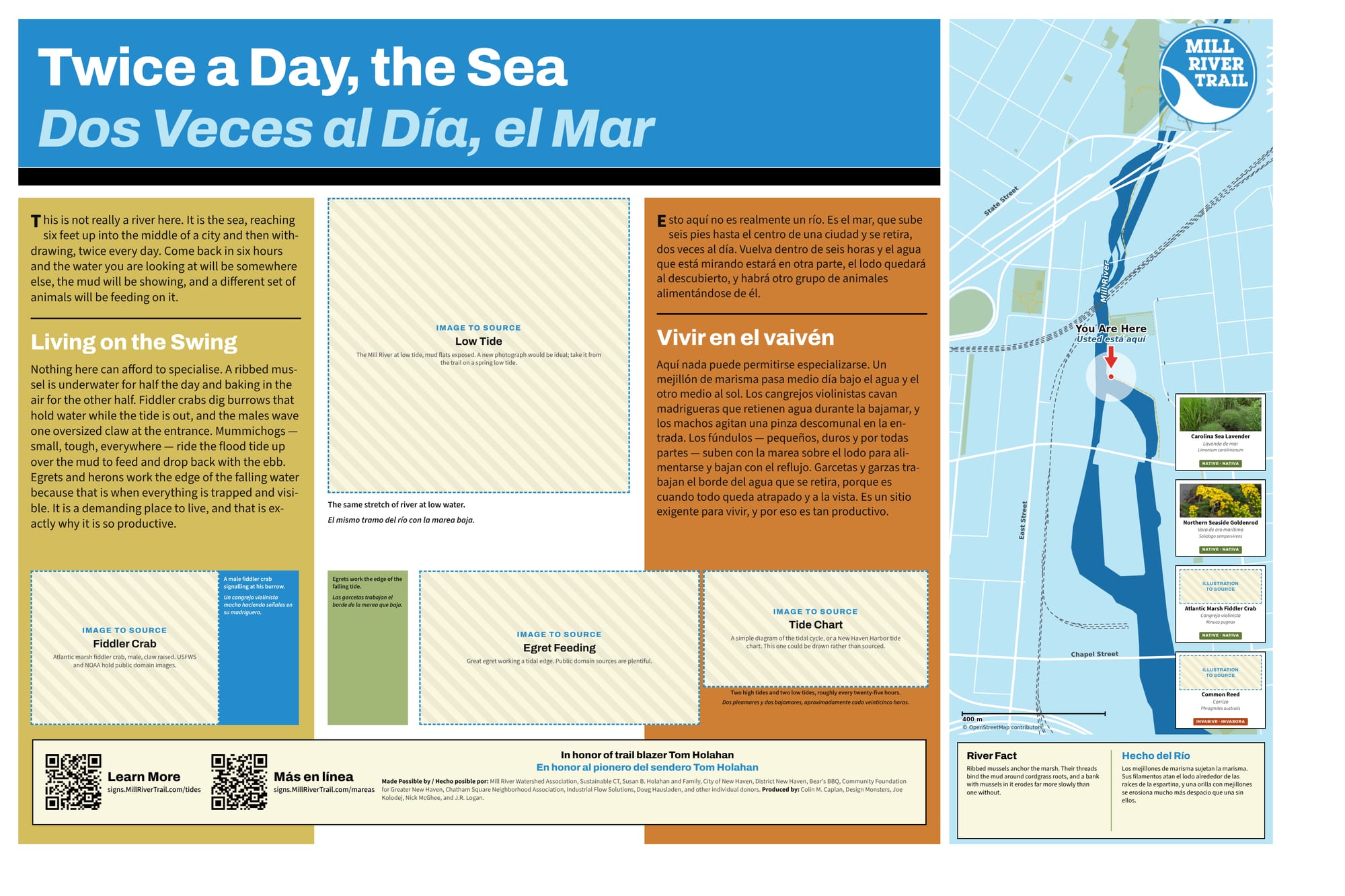
The full sign, in English and Spanish. Zoom in to read it.
This sign is still a draft. The hatched boxes are photographs that have not been sourced yet.
Sources and further reading
Where a link goes to a scanned original — a newspaper page, a map, an engineering journal — it is the actual document, not a summary of it.
- Mill River Watershed Based Plan — Save the Sound
- New Haven Harbor tide predictions — NOAA Tides and Currents
- Tidal wetlands — Connecticut DEEP
- River herring — NOAA Fisheries
Research and credits
Historical research for the Mill River Trail signage was carried out by Colin M. Caplan of Magrisso Forte and John R. Logan, with contributions from Jason Bischoff-Wurstle of the New Haven Museum and walk notes by Steve Hamm. Images are credited individually. Locator maps are drawn from OpenStreetMap, © OpenStreetMap contributors, ODbL.
This page last changed 2026-10-12.